


Maastokartat

Description of Maastokartat
Maastokartat is an application designed for outdoor enthusiasts, providing users with detailed topographic maps and various navigation tools. Available for the Android platform, Maastokartat allows users to download the app and access essential features for exploring both familiar and new terrains.
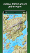
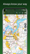
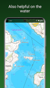
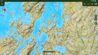
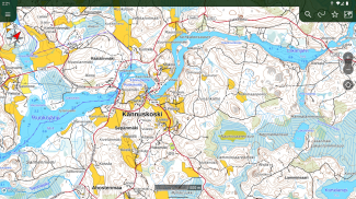
The app offers a topographic map based on data from the National Land Survey of Finland, which provides accurate information for outdoor activities. Users can view aerial imagery and satellite images of locations worldwide. The map displays user locations with real-time tracking, making it easier for individuals to navigate their surroundings.
Maastokartat supports various coordinate display formats, including WGS84, ETRS-TM35FIN, YKJ, KKJ, and MGRS. This feature is particularly useful for users who require specific coordinate systems for their outdoor activities. A built-in compass assists with map rotation and helps users orient themselves based on their direction of travel.
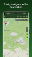
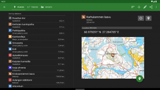
Navigating to a destination is simplified within the app, as it provides clear directions and distance information. Users can perform place name searches to find specific locations, which enhances their ability to plan routes effectively. Distance measurement tools are also included, allowing users to calculate distances between points of interest.
The capability to save personal places is another feature that adds convenience. Users can organize their saved locations and routes into groups, facilitating easier access to frequently visited spots. Furthermore, the app allows for sharing and importing of places and routes as GPX files, enabling users to collaborate with others or transfer information between devices.
A backup option to Google Drive ensures that users can keep their data secure and accessible. For those interested in fitness tracking, Maastokartat includes heart rate monitoring with BLE heart rate sensors, making it a versatile tool for both navigation and health tracking.
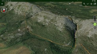
For a more enhanced experience, users can subscribe to Maastokartat Plus. This subscription unlocks additional features, which include high-definition topographic maps that provide elevation and depth details. The Plus version also offers hillshaded maps, which visually represent elevation differences, and 3D aerial and satellite imagery for a more immersive view of the landscape.
The worldwide outdoor map based on OpenStreetMap data is an added advantage in the Plus subscription, allowing users to explore areas beyond Finland with ease. Offline maps are available as well, enabling users to preload maps of selected regions into their device memory, ensuring access even without an internet connection.
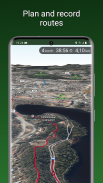
Route planning and tracking capabilities are expanded in the Plus version, allowing users to record and display their traveled routes. The app includes tools for pre-planning routes, making it ideal for individuals preparing for hiking or outdoor adventures. Users can also draw areas and measure surface areas, which can be beneficial for various outdoor activities.
Another feature in the Plus subscription is the ability to share locations among users. This function enables collaboration on outdoor activities, as users can draw another user's track on their own map, making it easier to follow established paths or plans.
Property boundaries and identifiers are presented as separate map layers, providing users with valuable information while navigating through different terrains. This feature can be particularly useful for those interested in land use, property exploration, or outdoor planning.
Maastokartat caters to a range of users, from casual hikers to serious outdoor adventurers, by providing tools that enhance navigation and exploration. The combination of free and paid features ensures that users have access to a robust set of tools tailored to their needs.
The app is designed to facilitate outdoor exploration, making it easier for users to determine their location and understand their surroundings. With the ability to save interesting places and navigate to various destinations, Maastokartat serves as an essential companion for those who enjoy spending time outdoors.
For users looking to enhance their outdoor experiences, the combination of detailed topographic maps, real-time tracking, and advanced navigation features makes Maastokartat a practical choice. The Plus subscription further enriches the user experience with high-definition maps and additional functionalities tailored for outdoor activities.


